Services
a leading aerial mapping and geospatial services company
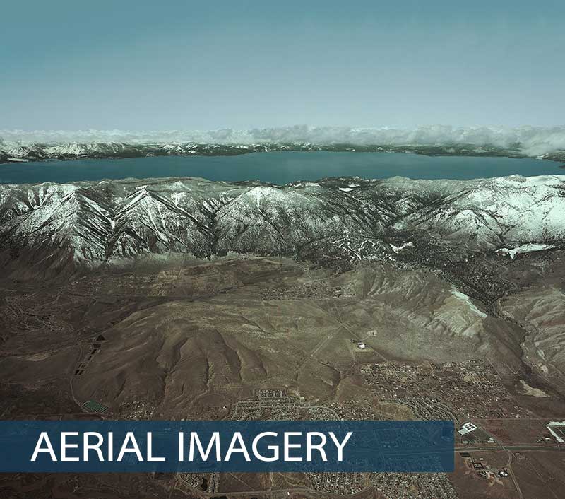
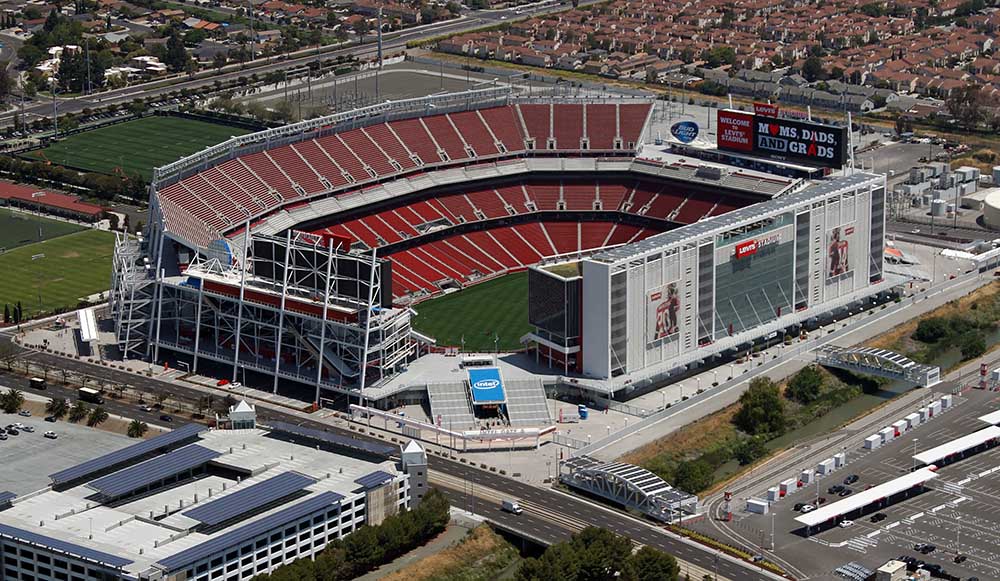
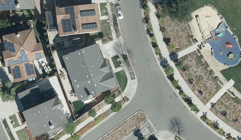
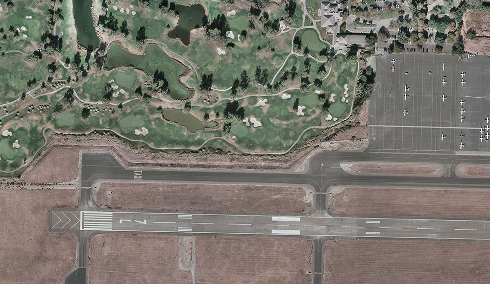
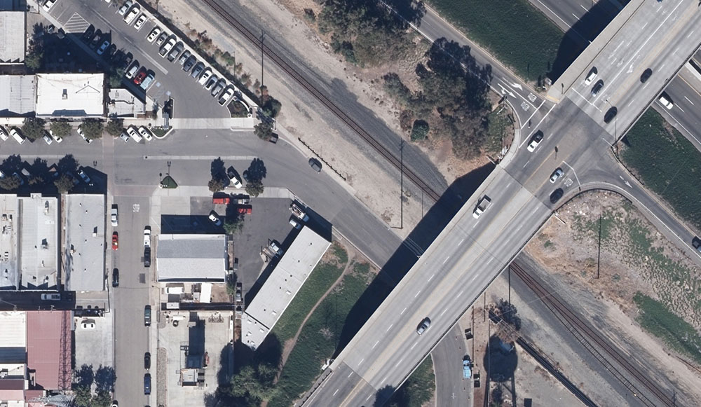
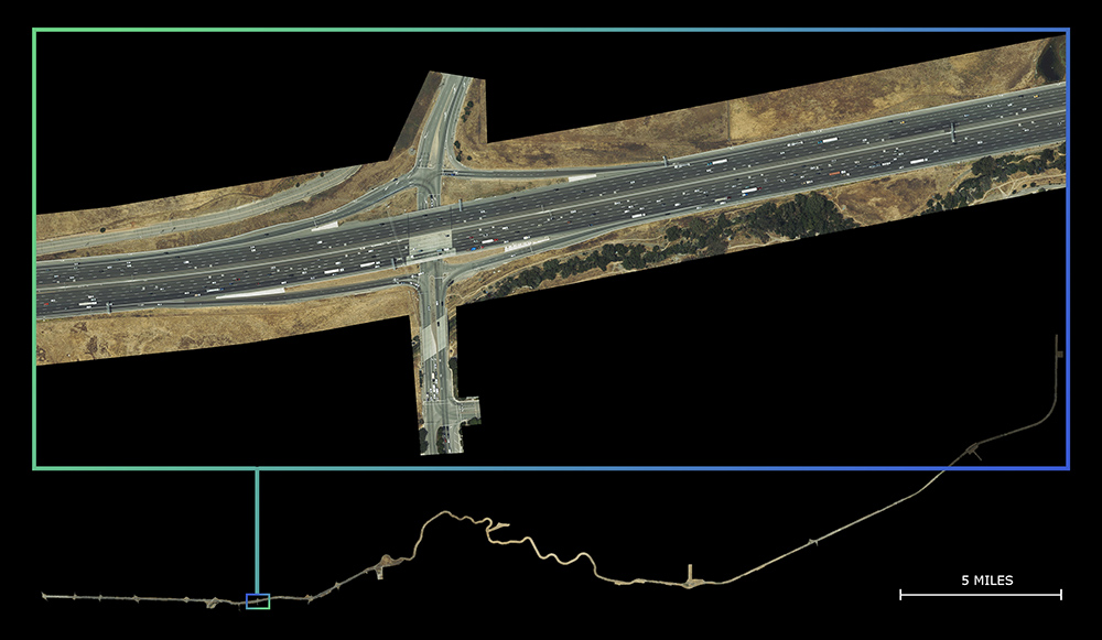
Aerial Photography
- Digital or traditional film imagery (B/W, color or IR)
- Oblique aerial imagery and processing
- Controlled vertical imagery and processing
- Airborne GPS controlled imagery
- Inertial Measurement Unit (IMU) controlled imagery
Vertical Mapping Resources teams with a select group of both digital aerial collection and aerial photography providers in order to offer a diverse fleet of planes and equipment that have the capabilities to efficiently perform on any project, within most geographic locations in North America.
The majority of our projects are flown using aircraft equipped with state-of-the-art digital sensors such as the UltraCam Falcon Prime (UCFp) and UltraCam X (UCX), or precision photogrammetric cameras, each equipped with forward motion compensation (FMC). FMC is a camera function that compensates for the perceived movement of the earth below. This significantly reduces blurring and results in the sharpest photographic image possible.
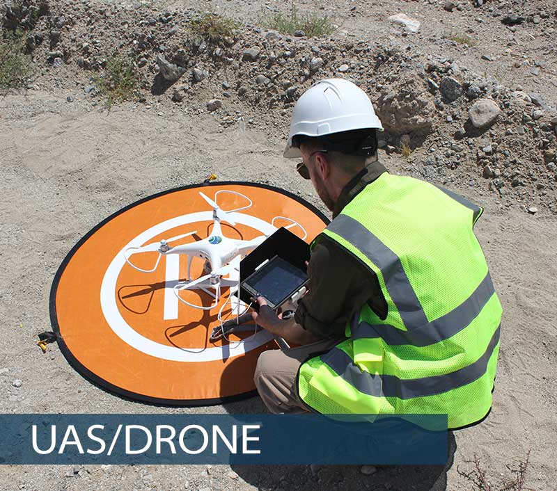
UAS/Drone
-
- Data acquisition and processing
- 3D mapping
- Surface modeling
- Volume calculations
- Inspection
- Lighting studies
- Photo and video
- Agriculture
- Multiple deliverable formats include: AutoCAD, Civil3D, Pix4D, Rhino 3D, etc.
Vertical Mapping Resources stands ready to meet the challenges of evolving technologies. In addition to its lineup of mapping services, VMR has expanded its offerings to include drone based services. Because UAV mapping is a new industry with undeveloped methodologies, it is important to work closely with our clients to create processes and deliverables tailored to their needs. Our in-house UAV fleet and FAA certified pilots ensure that we can capture our client’s needs on demand from any of our regional offices. Additionally, we can process data in multiple CAD platforms, Pix4D, and Rhino 3D in order to provide a range of deliverable formats to meet and exceed our client’s expectations.
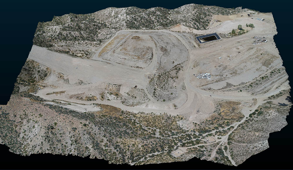
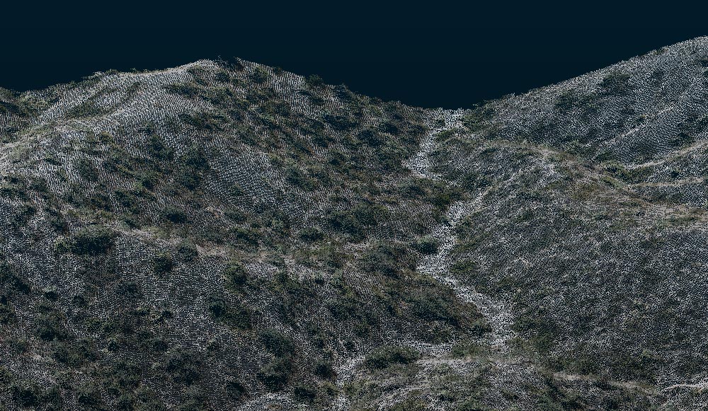
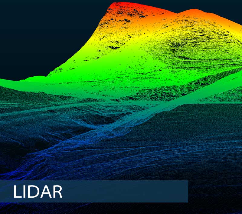
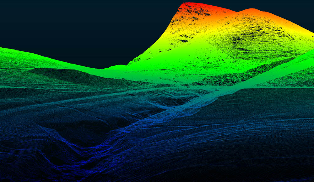
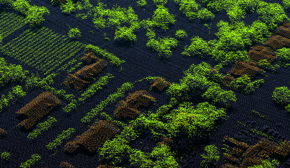
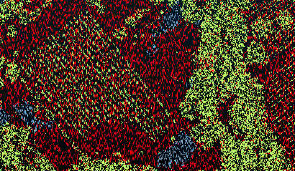
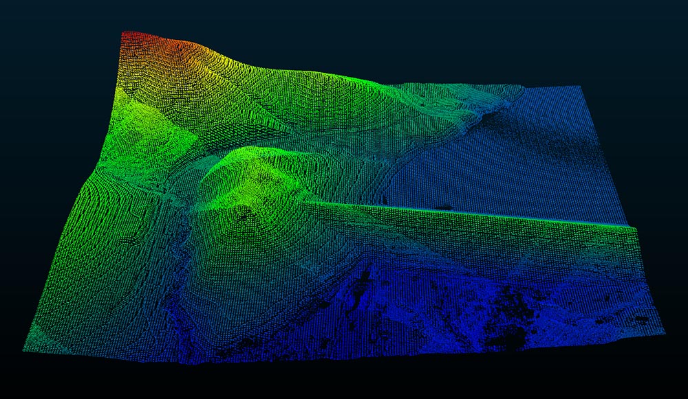
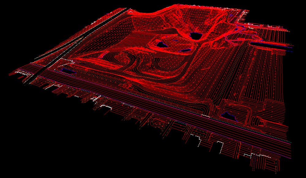
LiDAR
-
- Digital elevation models (DEM)
- First return canopy data
- Bare earth data
- Transmission lines/corridors
- Volume calculations
LiDAR (Light Detection and Ranging) is an optical remote sensing technology that measures properties of scattered light to find range and/or other information of a distant target. Similar to radar technology, which uses radio waves instead of light, the range to an object is determined by measuring the time delay between transmission of a pulse and detection of the reflected signal.
A typical LiDAR system transmits pulses of light that reflect off the terrain and other objects. The return pulse is converted from photons to electrical impulses and collected by a high-speed data recorder. Knowing the speed of light, time intervals from transmission to collection are easily derived. Time intervals are then converted to distance based on positional information obtained from ground/aircraft GPS receivers and the on-board Inertial Measurement Unit (IMU) that constantly records the attitude (pitch, roll, and heading) of the aircraft.
Vertical Mapping Resources uses proven commercial sensors for LiDAR data collection. LiDAR sensors collect positional (X,Y) and elevation (Z) data at pre-defined intervals. The resulting LiDAR data is a very dense network of elevation postings. The accuracy of LiDAR data is a function of flying height, laser beam diameter (system dependent), the quality of the GPS/IMU data, and post-processing procedures.
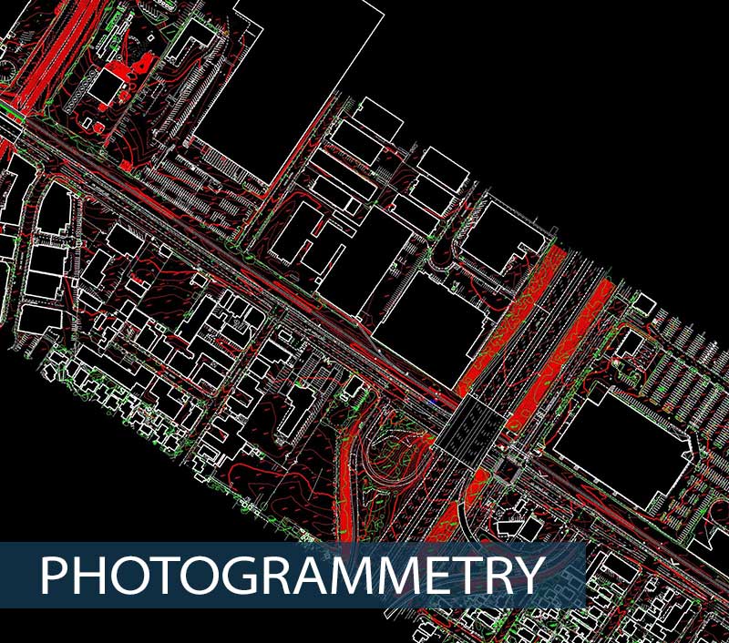
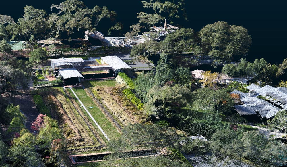
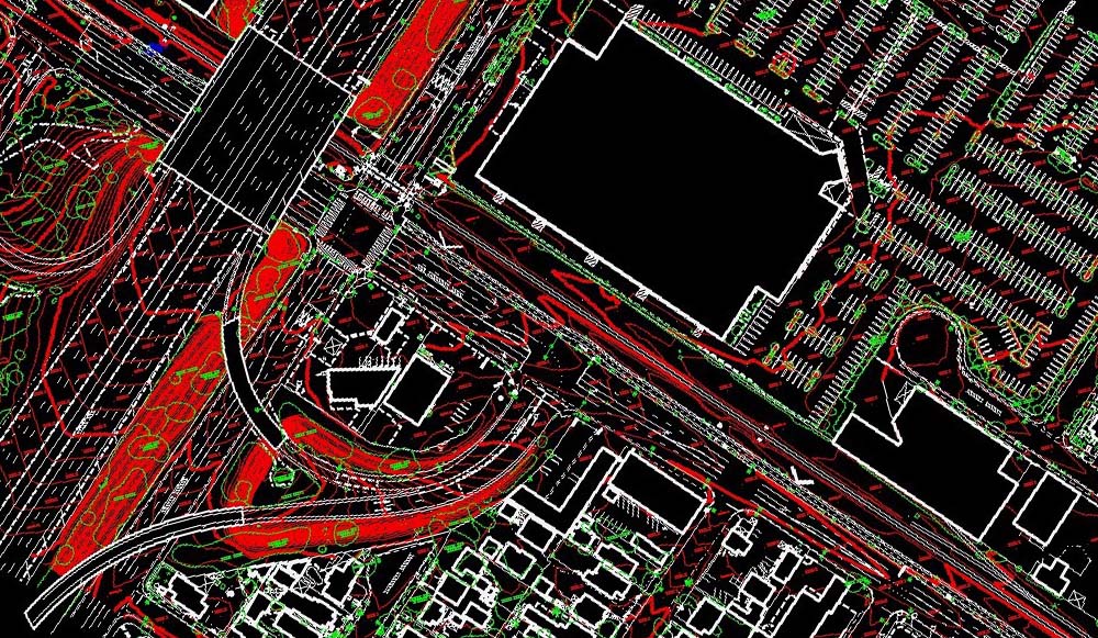
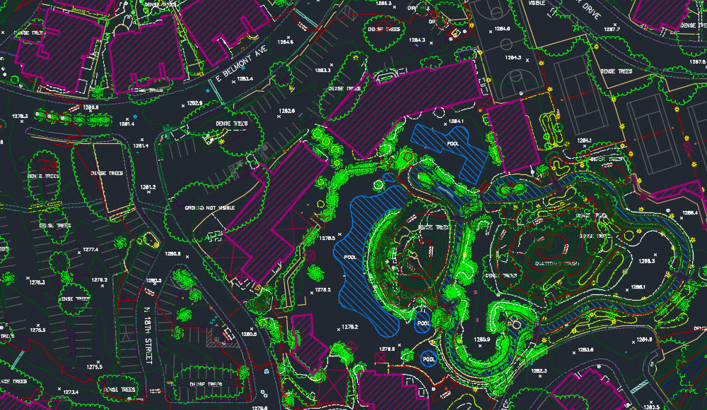
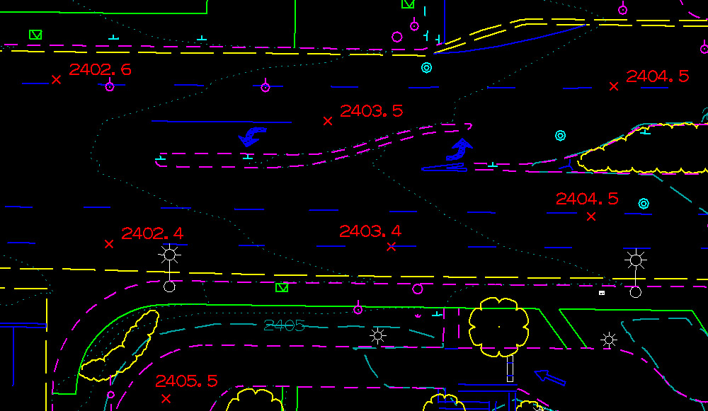
Photogrammetry
- Aerotriangulation
- Planimetric mapping
- Topographic mapping
- DTM/DEM/Surface modeling
- Contour generation
- Volume calculations
- GIS basemapping
- Multiple deliverable formats include: AutoCAD, Civil3D, Microstation, InRoads, ArcGIS, etc.
Photogrammetry is the first remote sensing technology ever developed in which geometric properties about objects are determined from photographic images. Historically, photogrammetry is as old as modern photography itself, and can be dated to mid-nineteenth century. Photogrammetry has been defined by ASPRS as the art, science, and technology of obtaining reliable information about physical objects and the environment through processes of recoding, measuring, and interpreting photographic images and patterns of recorded radiant electromagnetic energy and other phenomena.
Aerotriangulation (AT) is the first and most critical process in photogrammetry. VMR utilizes ImageStation Automatic Triangulation (ISAT) software package. ISAT is an exceptional automatic triangulation package that delivers the best-matched multi-ray tie points by using built-in bundle adjustment during all phases of the image matching process. The AT process is a system of measurements of passpoints and tiepoints to relate multiple, overlapping images to each other. Ground control coordinates are incorporated in order to locate the imagery accurately to its position on the earth. The relative orientation is computed and the software calculates residuals on each measured point. The final output from the bundle adjustment will provide the parameters required to set up the softcopy stereo equipment for accurate topographic mapping.
VMR utilizes digital photogrammetric workstations for stereoscopic map collection. These workstations allow for efficient, accurate data collection while maintaining the ability to easily customize data to individual client needs (layering, symbols, etc.).
A digital terrain model (DTM) is the basis for all contouring, orthophotography, TIN calculations and other surface modeling. The DTMs collected on our workstations are comprised of mass points and breaklines. Breaklines delineate various terrain defining features, such as ravines, ridges, tops and toes of slopes. Unless otherwise specified by our clients, VMR always collects a full DTM to provide the most accurate surface model possible in order to meet and exceed ASPRS class 1 accuracy standards, as well as the FGDC’s National Standards for Spatial Data Accuracy (NSSDA).
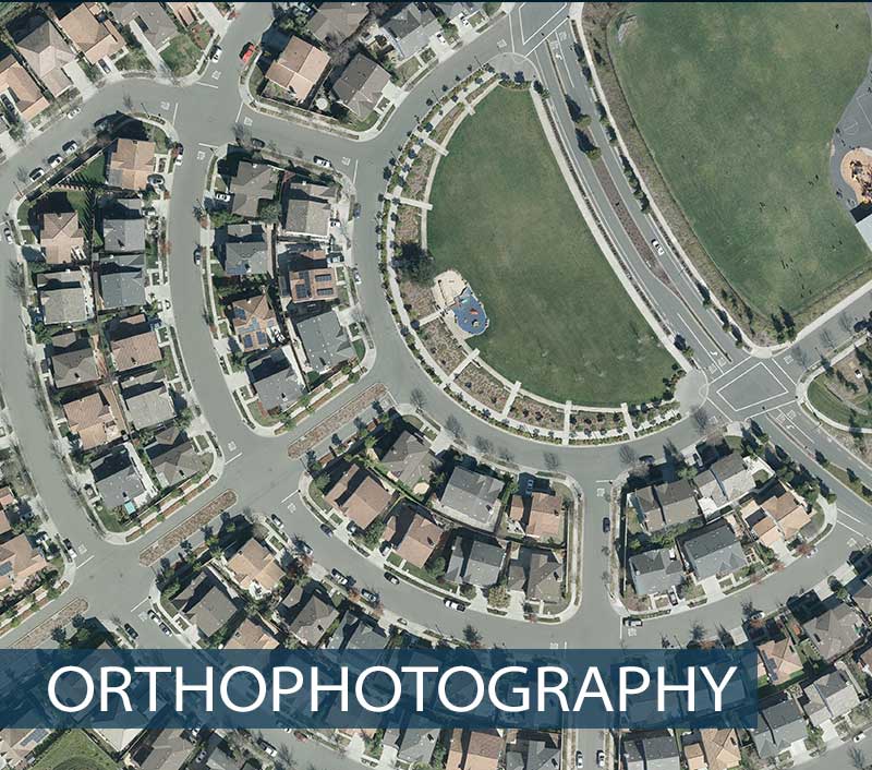
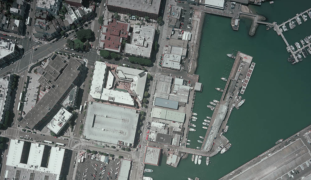
Orthophotography
- Digital orthorectification
- 3D models with ortho overlay
- Mosaics
- Image interpretation & classification
- Compression (SID & ECW)
Digital orthorectification corrects image distortion introduced by camera tilt, terrain relief displacement, film deformities, lens aberrations and atmospheric refraction. Digital orthophotos combine the high visual information of a photograph with the geometric accuracy of a map.
Vertical Mapping Resources employs OrthoPro software to perform image rectification. OrthoPro is a high throughput ortho production system that includes rectification, tonal balancing, mosaicing, and quality assessment. Utilizing the sophisticated tools contained within OrthPro, VMR performs contrast stretches, advanced filtering routines, re-sampling and radiometric correction as necessary to provide the highest quality imagery product available.
With the widespread increase in the use of Geographic Information Systems (GIS) for land, facilities, and resource management, digital orthophotos can be created at an accuracy such that they can serve as accurate base maps for GIS. Since orthophotos are georeferenced, they can also serve as a backdrop to existing vector or cadastral maps, and therefore be valuable for direct interpretation, GIS updating and for digitizing new layers of cadastral information.
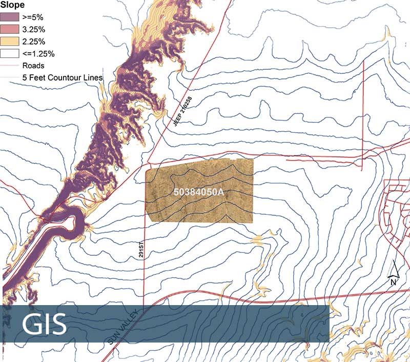
GIS
- Remote sensing
- Geospatial analysis
- Geodatabase development
- Custom web applications
- Data collection/extraction
- Cartographic services
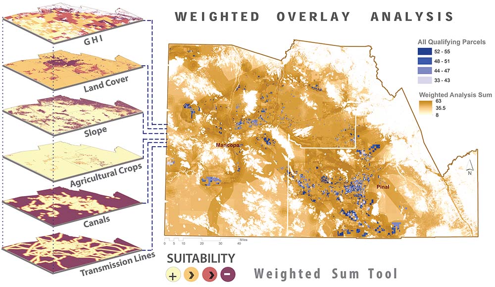
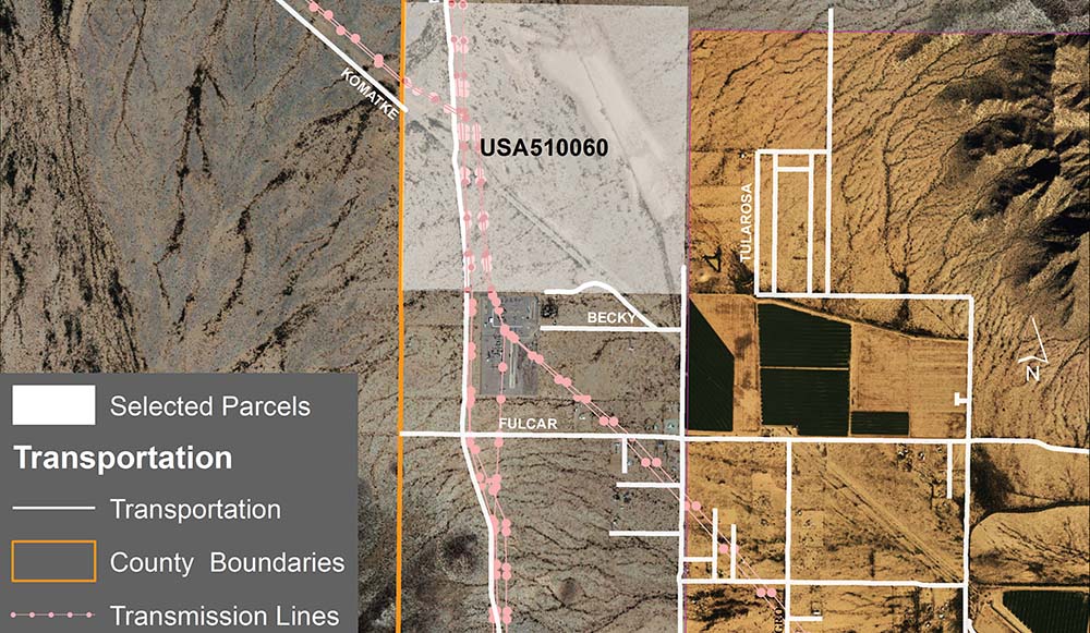
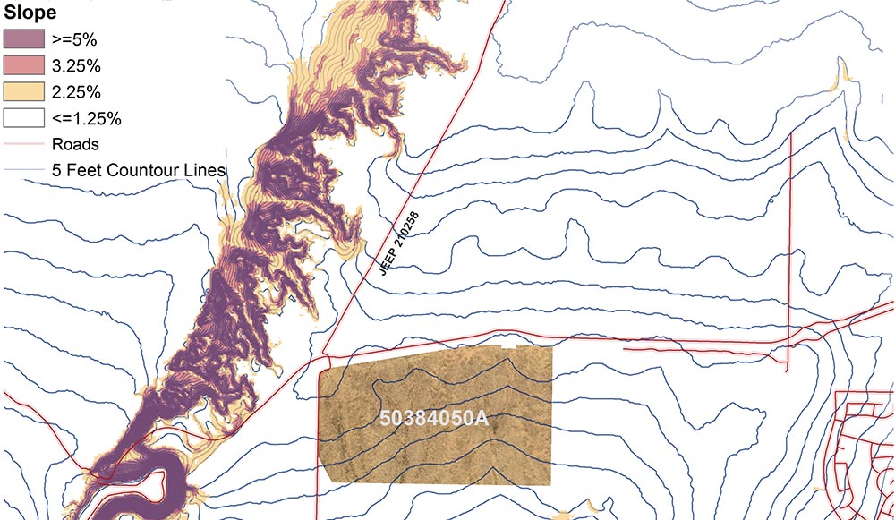
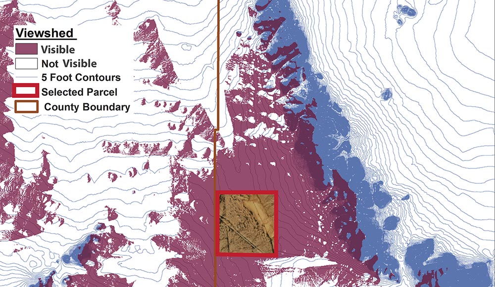
ESRI defines a geographic information system (GIS) as a framework for gathering, managing, and analyzing data. Rooted in the science of geography, GIS integrates many types of data. It analyzes spatial location and organizes layers of information into visualizations using maps and 3D scenes. With this unique capability, GIS reveals deeper insights into data, such as patterns, relationships, and situations—helping users make smarter decisions.
Vertical Mapping Resources works with our clients to fully understand and create their vision of an efficient and accurate GIS.
Some of the specific areas VMR can assist with include:
Data Collection and Geospatial Analysis
- Demographic data collection and analysis
- Data collection/extraction of civil engineering features
- Map georeferencing and digitization
Geospatial Data Management (a must on most projects)
- Create, setup, and implement a centralized geospatial database
- Data conversion of existing files to appropriate formats
- SQL data querying (data filtering, data cleanup)
Cartographic Services
- Generation of maps that satisfy federal and state standards.
- Beautiful basemaps generated from aerial photography or other sources
Multispectral Imagery Collection and Analysis
- Difference vegetation index (DVI)
- Normalized cifference vegetation index (NDVI)
- Vegetation density
- Tree identification